OCEAN CN Consultancy Network
Projects
URBANISM: MASTERPLANNING + URBAN DESIGN + INFRASTRUCTURE + LANDSCAPE
OCEAN CN aims to conceive and deliver unique architectural spaces, by innovating standard structural, tectonic and material systems with design method, linking digital generative design, production, manufacturing and assembly. OCEAN CN applies its range of experience in architecture, interior conversions and fit-outs, material development and furniture, towards the design of prototypical environments, which are both locally specific yet globally significant.
With extensive project experience on urban sites located across Asia, Europe, North America, and the Middle East, OCEAN CN’s portfolio demonstrates a commitment to producing complex yet coherent urban spaces. In our urban work, we embrace urban change and to surrender to the complex dynamics of the city, while paradoxically, cultural, social, environmental and economic resilience. In addition, we aim for creating greater spatial differentiation between and within any given city, confronting the legacy of standardized, repetitive modes of production, in favour of a more distinctive and locally informed urbanism.
Europan 4: Jeumont Housing & High Speed Transport Interchange
Situated on partly disused SNCF railway land, Jeumont is positioned to become a commercial, cultural and infrastructural hub of the region. A multi-modal transportation network allocates a new TGV link along with three mixed-use air-rights transfer buildings that mediate the motorway connection as a pliant mass that bridges the railway lines. A variety of 2 floor maisonettes, single level studios, one, two and three bed apartments are distributed, ranging between 30m2 and 100m2. A construction system of sectionally extruded 12m wide slabs has intermittent shear helical cores at each inflection in the geometry, organising vertical circulation, structure and mechanical services. The intersections of the variable edges of the floor slabs with two external skin systems produce a variety of vertical interior landscapes, mezzanines, double-height spaces and, exterior terraces. A three-dimensional twenty year phasing strategy aims for the initial scheme to adapt to future contingencies.
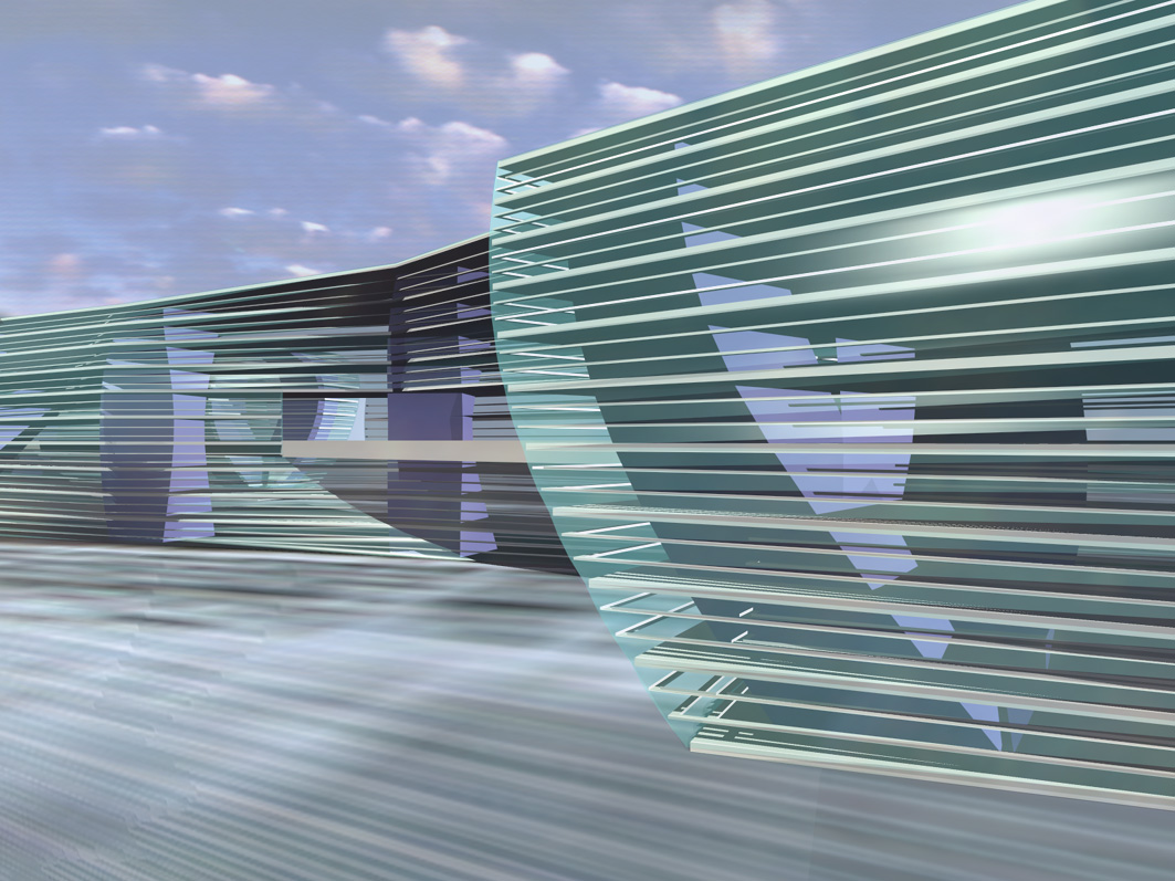
Lasipalatsi Square
The proposed Media Square is located adjacent to the Finnish Parliament and the new KIASMA museum. A new multiple-use complex and a new National Transportation Terminus are strategised within a 400m x 175m topographical network of tectonic, programmatic and, sensorial systems. The physical structure of the media square is a long span laminated polycarbonate beam structure sheathing a seamless permafrost surface of the 12 month skating rink with mediated programmed surface visuals. A sub-surface 12 month summer courtyard system is linked to KIASMA, Central Station, the metro system, shopping and service facilities and, Helsinki’s pedestrian network. The square integrates into the linear park system of Helsinki via a sectional urbanism that blends a multitude of urban activities within an artificial landscape of elevated stranded surfaces. The effects of the urban square demarcate a transition from classical open space towards a deep gradation of porous urban interiors and exteriors.
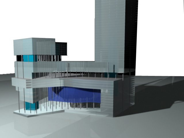
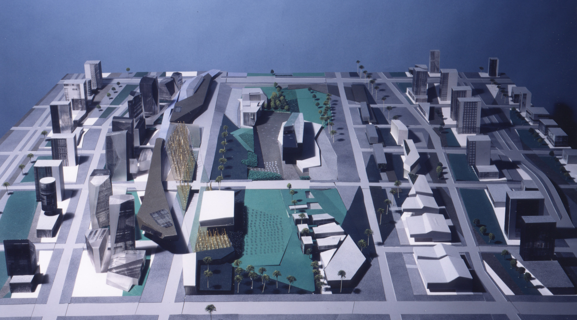
Multi-use Complex
The project comprises 174 000 m2 of total gross floor area, rising to 88 floors above ground. The limited competition calls for the tallest building in the world. Four major program volumes distribute an extra-large, interior urbanism: An Apartment/hotel tower [Z], comprising 700 serviced apartments and suites; The tower is formed by a tall vertical element folding into a plinth that descends and levitates the commercial and recreational activities. An Office block is raised above the plinth, whilst the 1500 seat KL-City Concert Hall is suspended between the ground and the Higher Level Car Park [C] for 2000 cars. The car park folds above and below the sloped commercial duty-free terraced ground level, as well as the concert hall. A landscape scheme provides urban spatial reserves at various roof and intermediate levels within its sectional organisation, accomodating several types of exterior public parklands and covered urban public spaces. The scheme defines the Ground Level as a terraced landscape on a sloped ground plane, connecting the vehicular, pedestrian and public transport access points to the various programs of the multi-use complex.
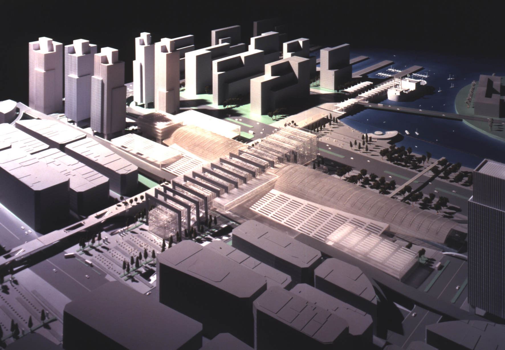
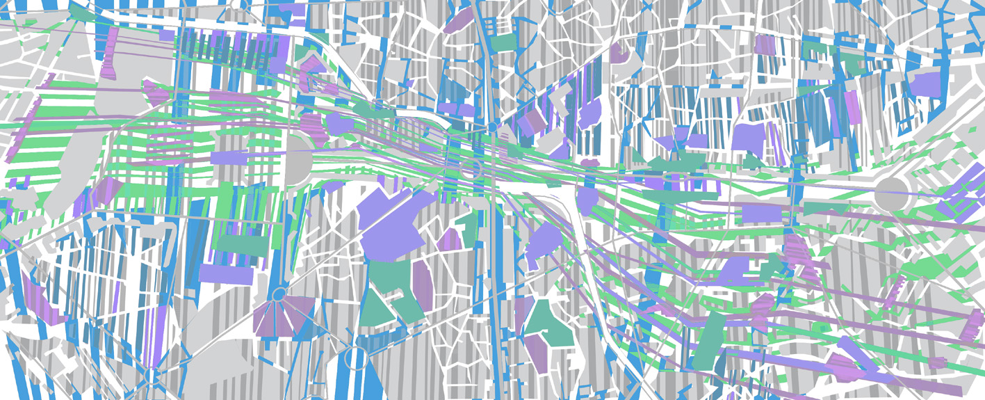
Busan Railway Complex and Masterplan
This joint-venture collaboration called for an urban masterplan of 500 000 m2 of newly reclaimed urban waterfront development and, a proposal for a 150 000 m2 high-speed railway complex for the southern terminus of the TGV based railway of South Korea, including civic, commercial, retail, recreation and, entertainment facilities. A logistic phasing schedule maintains the unimpeded operation of the existing railway station in full operation while constructing the new complex around, over and under the existing facilities. Initially, the primary infrastructure and train lines will establish urban connectivity to link the city with the new ocean park and waterfront development. The first phase of landscaping is then initiated, enhancing the connectivity of Pusan to the waterfront, followed by the construction of the main concourse enhancing the coastal linkage. An extra-large sequence of open public spaces weaves parallel to the tracks. By year 2, the masterplan buildings for private speculation and, civic and cultural institutions is commenced, followed by the development of secondary facilities within a continuous urban landscape along and across the railway complex, to further strengthen the link between the city and the ocean. The proposal ends by opening the ongoing development of the masterplan via future urban design reviews and design competitions for specified sites.
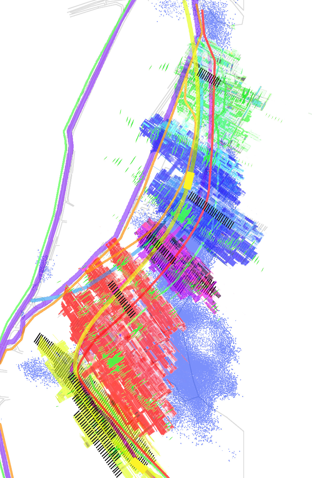
Bucharest 2000
The proposal aims to describe a multiplicity of adaptable spatial guidelines for several possible futures of Bucharest to be evolved over time. The oblique intersectional space of the Dambovita River and the vacant land of the Ceaucescu urban demolition zones enables mediations between a the permeable and densified urban edge fabric and a vast, public urban landscape core. The supple north-south orientation of the historic urban organisation is restores connections across the core. Space Syntax was instrumentalised with ARUPS, testing initial axial connectivity, integration mapping, potential network linkages and, resultant growth patterns in multi-phased increments across the public core. The Ceausecu regime removed churches from their original locations and, were relocated in existing perimeter block courtyards. This new spatial type informs a projected incremental regime of dispersed cultural, commercial and landscape attractors. Four primary programmatic zones are strategised to install a range of identities to Bucharest: An Olympic Park and Expo zone in proximity to the People’s Palace; A Political and Diplomatic territory; Aid and Trade agencies; Mixed use residential. The proposal aims for a concurrence of top-down Planning strategies and bottom-up public/private architectural and investment opportunities.
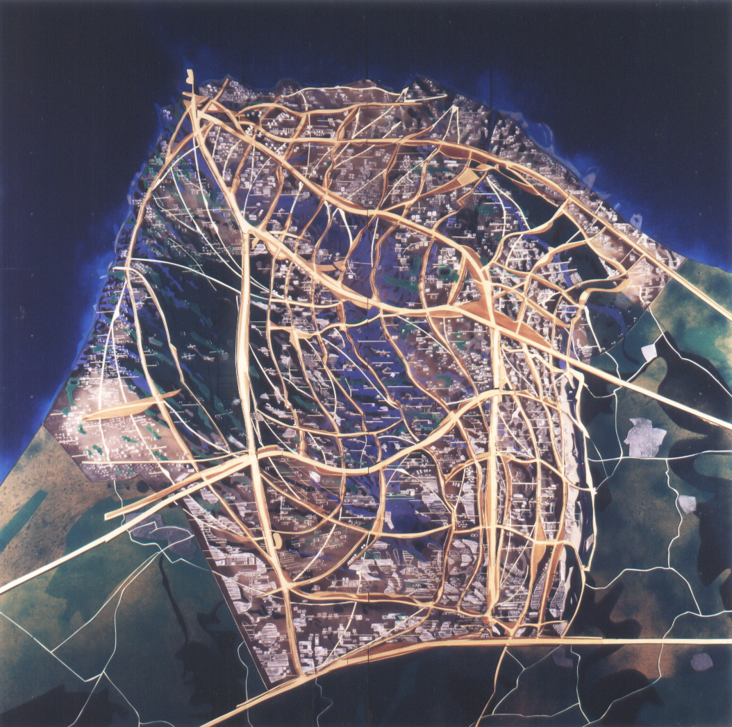
Arabianranta Urban Masterplan and Urban Design Study
Arabianranta is a 3 km2 coastalsite located north-east of central Helsinki. The site has been reclaimed incrementally reclaimed from over a century of toxic landfill by nineteenth century industries located along the coast. The initial analysis of the existing City Planning Department masterplan detects several valuable diagrammatic qualities, which are maintained, whilst subverting the inherent exclusive single use zoning of the existing proposal. As a response to the critical failures of urban planning, the three phased study describes sectional design policies to guide a potential blending of urban public surfaces, private territories, built volumes, and coastal urban landscape systems. The strategies extend the peninsular and archipelago landscape organisation, integrating the site into the linear park system of Helsinki via a multiple coastline structure. Five programmatic zones of intensity are interspersed with the continuous coastal landscape, aiming to install the various constituents, including: an Ecological Research Facility adjacent to two existing universities and a bird reserve; an Edu-tainment zone of media production and consumption; a Marine Transportation Node for passenger and recreational boating; a Soft Commerce zone that aims to adapt and densify existing small-business organisations; and, a Road and Rail Transportation Node that progressively integrates existing amenities. ARUPS Consulting Engineers strategised an infrastructural and ecological incremental phasing scheme. The urban design strategies yield the coexistence of multiple programmatic surfaces on each lot, intertwined within a co-operative logic of public and private ownership. The site is assumed to be complete given all potential scenarios and, at any stage of the development of the proposed strategies.
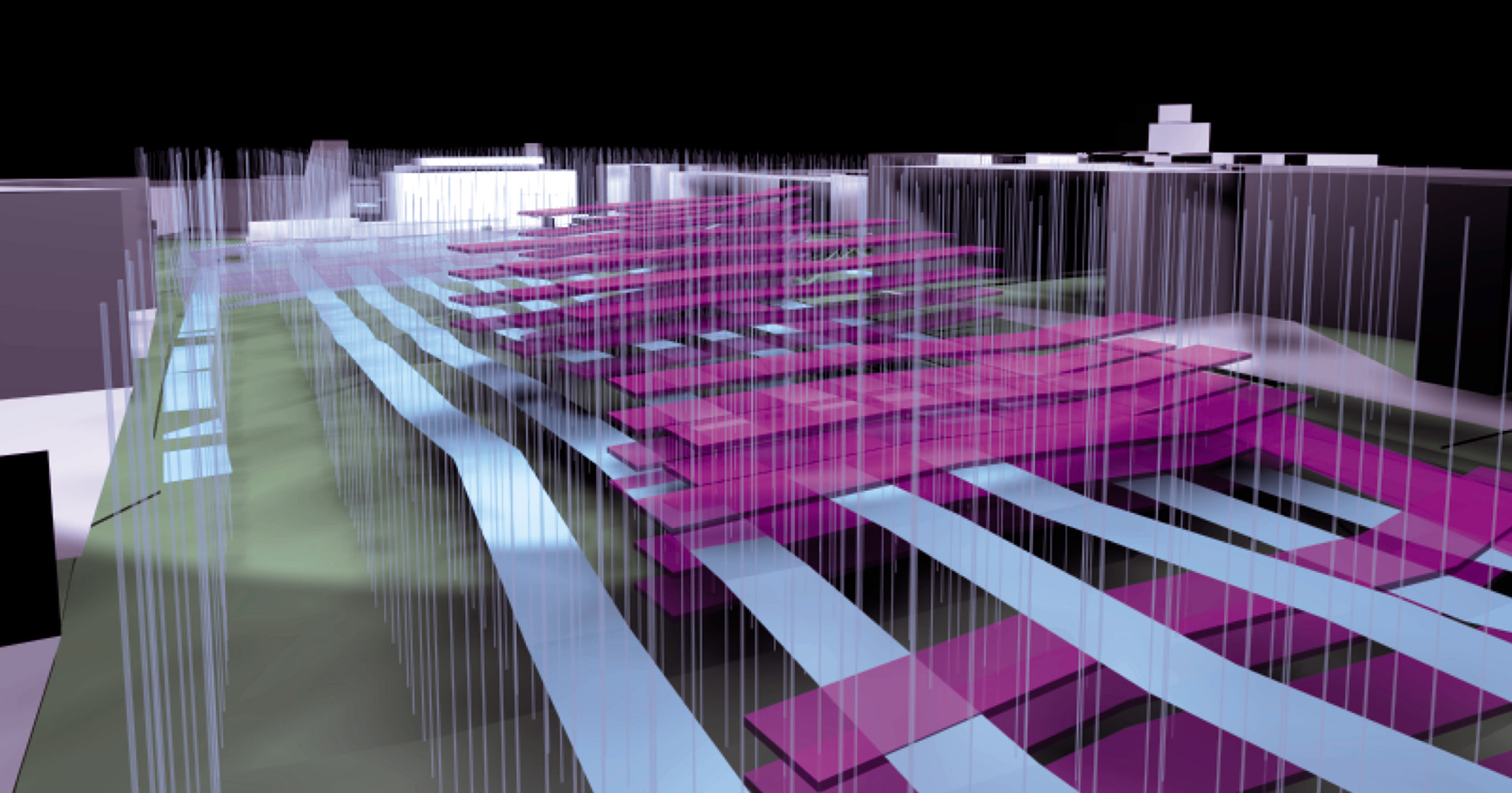
Changliu Grouping Area CBD Urban Design
This 64 km2 masterplan aims to urbanise a peninsula adjacent to Haikou City and the Macun Grouping Area on Hainan Island. The project aims to install the desirable complexity of a city, with a high level of coherence and identity. In this first phase, a range of spatial, programmatic and institutional organisations are distributed with differential densities of buildings, landscape and infrastructural amenities. The roadways are extended to include public urban plazas with soft commercial enterprise.The ‘urban ocean’ extends from north to south, providing a dynamic public event space for cultural and civic amenities. A Ferry Port Terminal for passengers and cargo is positioned at the nothern tip of the peninsula, and the road network links the adjacent urban satellite centers.
Changliu Grouping Area Masterplan
This second phase urban design submission focussed on a 3 km2 Central Business District of the 64 km2 Changliu Grouping Area. The client provide the parameters of the central axis, the simple gridded lots and the perimeter road as parameters, a further organisation is proposed, cohering buildings, landscapes, and infrastucture into a dynamic spatial experience. A Concept Plan integrates three systems across the site: Buildings and Lots, Hard Landscape, Soft Landscape. A 3D Concept Model organises the complex spatial relations of building envelopes, their surrounding and interpenetrating landscapes. A central area is an urban sea, where civic and cultural buildings float in an artificial topography. We proposed systems to organise building setbacks, heights and envelopes, as an alternative to standard Floor Area Ratio methods of controling development. This promotes a constantly transforming set of spatial conditions, establishing more cohesive identity to the CBD. The project differentiates four species of buildings, including Civic and Cultural, and Urban Mall, Piloti buildings, and general development.